Project Overview
Project Name: Agricultural Field Analysis and Modeling using Satellite Time Series Imagery
Partner: Google Research
Sectors: Agriculture, Remote Sensing
Category: Computer Vision, Satellite Imagery, Machine Learning
Current Team:
- Professor Milind Sohoni
- Aaryan Dangi
- Lisan Kadivar
- Sameer Mannava
- Aditya Torne
Description: The project aims to use satellite imagery and various other data sources such as weather and soil quality to improve agricultural field analysis and inference. Key objectives include developing a robust model for crop presence, creating a confidence-based classification system for crop cycles, and implementing time series-based crop classification using attention-based neural networks. The project also involves incorporating region-specific data, soil information, and other relevant parameters to enhance the accuracy of predictions. Our end goal is to create an agri-IT stack that will help India assess farmer-specific cropping data: yields, crop health and overall farm history.
Current Status
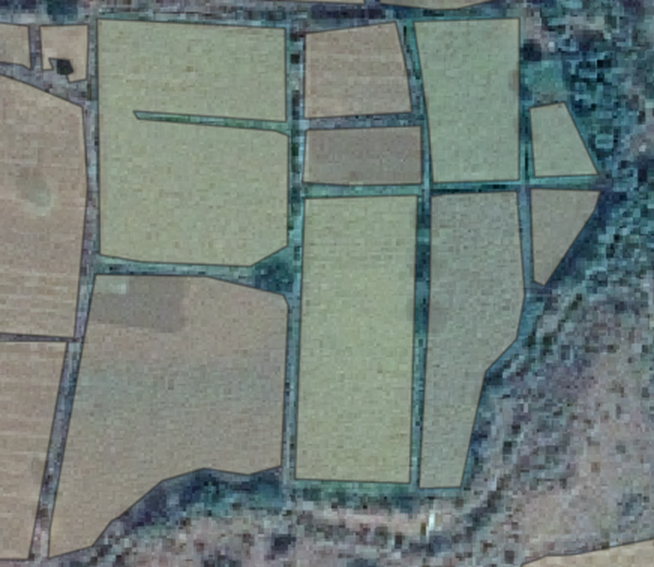
Our team has been working with Google farm plots (polygons that represent lat-lon coordinates of fields) for over a year now, using them in the context of ownership-possession reconciliation. We are quite new to using the raw satellite data for yielding information about crop history, however, with a lot of proof-of-concepts planned in relation to building agri-stacks at the farm plot level.
Skills Learned
Python
PostgreSQL
QGIS
Satellite Image Processing
Neural Networks
ML Architecture Design
Software Development
Qualifications Required
Year of study: Second year or above
Courses taken: At least one course or project directly related with Machine Learning and Satellite Imagery is recommended.
Experience: Knowledge of image classification with CNNs is appreciated, and so is familiarity with satellite image processing. Some interest in the agricultural domain (cropping patterns, agri-cycles, etc) is appreciated.
Work Description
Roles: 1 Satellite ML Development Position
Stipend: Paid project (join community for more details)
Project Duration: 3 months
Tasks/Deliverables:
- Crop Presence Model: Develop a machine learning model to accurately identify the presence of crops in satellite imagery.
- Crop Cycle Confidence Classification: Implement a classification system that assigns confidence levels to different stages of the crop cycle based on satellite data.
- Time Series-Based Crop Classification: Utilize attention-based neural networks to classify crops over time, considering temporal changes in satellite imagery.
- Incorporation of Weather Data and Soil Information: Enhance the models by integrating region-specific data and soil characteristics to improve the precision of crop classification.
- Crop Health and Yield Assessment: Extend the analysis to include the assessment of crop health and prediction of crop yields based on satellite imagery and additional parameters.
How to Apply?
Submission link: https://forms.gle/SDfFns7gpTbhtk398
Deadline: 11:59 PM, 17th April, 2024
To enroll for the project, you must fill the form above. For further credit, you can attempt and submit the assignment below to the best of your abilities, taking aid of any tools online. We will contact you personally if you are shortlisted for the interview.
(Optional) Assignment: Getting familiar with Satellite Images
The goal of this project is to develop a machine learning model for classifying the growth stages of crops based on clipped raster data. The dataset consists of clipped rasters for 569 geographical grid cells (GIDs) across 12 agricultural months. Find the dataset: here.
Task: Your task is to create a model that accurately classifies the growth stage of crops into the following categories: 'no_crop', 'growing', and 'lush'. You must annotate/label the fields yourself, to the best of your judgement. You can explain the process in the README, and submit your ground-truth annotations as a csv file in the GitHub repository.
Dataset Overview:
- Input Data: Clipped rasters for 568 GIDs.
- Temporal Coverage: 12 months.
Output Classes:
- no_crop: Indicates the absence of crops.
- growing: Represents the ongoing growth phase of crops.
- lush: Signifies a healthy and lush crop stage.
Tasks:
- Data Exploration: Begin with a thorough exploration of the dataset to understand its characteristics.
- Feature Engineering: Implement any necessary preprocessing and feature engineering techniques for optimal model performance.
- Model Selection: Choose appropriate machine learning algorithms for crop growth stage classification.
- Evaluation: Assess the model's performance using relevant metrics, such as accuracy, precision, recall, and F1 score.
Documentation: Provide explanation in 2 paragraphs of your methodology, model architecture, and reasoning behind design choices. Do this in your README.
Assignment Guidelines: Submit the trained model for evaluation as well as a README through GitHub. Ensure your repository is public.
Contact Us
For any general queries, join the ProSpace WhatsApp group- here.
For assignment queries, contact:
Email: aaryan.dangi@iitb.ac.in
Phone: 9987361968
Announcements
Recruitment Open: Satellite Agri-Modelling
01-Feb-2024Recruitment for the Satellite Agri-Modeling project is now open! Join the project and gain valuable skills in Python, satellite image analysis, compute vision and more. Check out the submission link and assignment to apply.